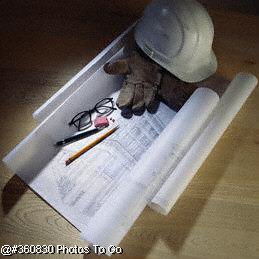
Since 1976, WALDEN & ASSOCIATES has
been committed to maintaining a comprehensive range of high-quality, professional services, while serving the expanding Southern
California region. Our excellent long term client relationships are the result of personal service, sensitivity to schedules,
and the resources of a quality design team that utilizes the latest technology and equipment to meet our clients specific
goals and requirements.
WALDEN & ASSOCIATES provides civil engineering, land planning, surveying and mapping services for large and small
projects to both the private and public sector. Development projects include master planned communities, residential
developments, office complexes, commercial centers and industrial parks. Community projects include public works and
redevelopment programs, institutional and recreational facilities. Our services are available to clients throughout
the various phases of a project, from initial planning, through complete site design, mapping and construction staking.
The Walden team has experience in the following disciplines:
|
|
Land Development and Public Works |
|
Engineering Feasibility Studies Project Site Design Tentative
Map Design Subdivision Engineering Street & Highway Design Traffic
Engineering Municipal Services Engineering Specifications & Reports On
Call Engineer for various cities
|
Hillside & Mass Grading Design Erosion Control Design Retention/Sedimentation Facilities Hydrology
& Hydraulic Engineering Flood Control Facilities Design Storm Drain Systems
Design Master Plans of Drainage
|
|
Water and Waste Water
|
Sewer & Water Master Plans Water Supply Engineering Water Distribution System Design Reclaimed
Water System Design Sanitary Sewer Design 
|
|
|
|
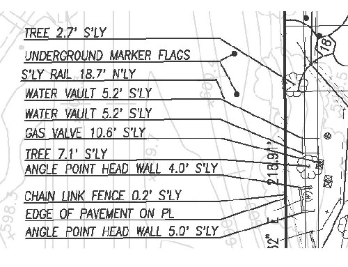
Mapping
|
Field Surveying
|
Aerial
Photogrammetry & Mapping Topographic Mapping Architectural Surveys ALTA Surveys Records of Surveys Subdivision Mapping Condominium Plans Geographic Information Systems Global Positioning Systems
|
Construction Staking Route Surveys High-Rise Layout Boundary
Surveys
|
|
Entitlements
|
|
|
|
Land Planning
|
|
Advance Planning
|
Current Planning
|
Planning Feasibility
Studies General Plan Elements Master Plans & Specific Plans Zone Changes Environmental Impact Analysis Development Agreements &
Cost Analysis
|
Site Planning Community Planning Infrastructure Analysis Entitlement-to-Use Coordination Redevelopment Programs C.U.P.'s & Variances
|